Changes in Snow Coverage Area in Illinois
Remote Sensing of the Environment • EAE 560 • Spring 2025
Project Summary
This study examined snow coverage trends in Illinois using Landsat-8 imagery (2014–2025). I calculated Normalized Difference Snow Index (NDSI) to detect snow cover in January (midwinter) and March (spring shoulder season). The results show increasing snow coverage in January but decreasing coverage in March, reflecting broader patterns of snow drought in the Midwest. Findings highlight the importance of regional snow monitoring for agriculture, water resources, and climate feedbacks.
Research Questions
- How has snow coverage area in Illinois changed between 2014–2025?
- Are midwinter and spring trends consistent with broader North American studies?
- How variable is snow coverage year to year?
Background
Snow cover affects water resources, agriculture, climate feedbacks, transportation, and ecosystems. While North American snow extent has remained stable in midwinter, spring snow cover has decreased, shortening the snow season by two weeks. Studies show declining snow depth and snowpack mass across the Great Lakes and Midwest, contributing to soil moisture deficits and drought risk.
Climate projections suggest continued reductions in snowpack mass and snowfall events, particularly at lower latitudes, raising concerns for Midwest water and agricultural systems.
Methods & Data
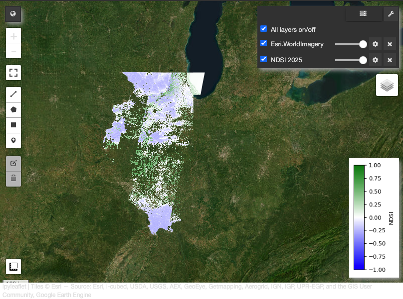
Data Sources: Landsat-8 (2014–2025), QA Pixel for cloud masking, U.S. Census shapefiles for AOI (Illinois).
- NDSI: Calculated with Bands 3 (green) and 6 (SWIR): \( NDSI = \frac{Band_3 - Band_6}{Band_3 + Band_6} \)
- Threshold of NDSI > 0.4 applied to create binary snow masks.
- Calculated statewide snow area (km² and % of Illinois area) for January and March.
- Generated time series and percentile statistics to assess trends and extremes.
- Attempted hotspot analysis using ArcGIS Pro (multidimensional rasters), though time formatting prevented completion.
GitHub repository with code: Snow Extent Project Repository
Results
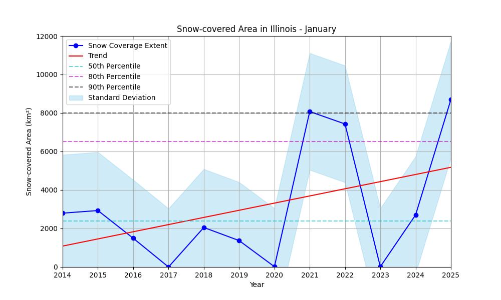
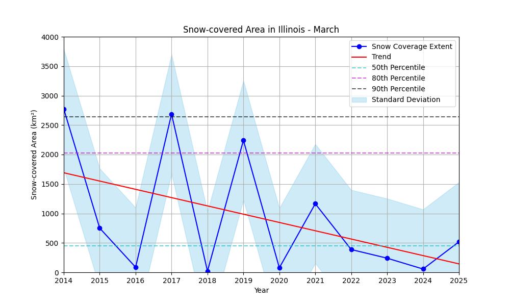
January: Increasing trend in snow coverage, with several extreme years (2021, 2025). March: Decreasing trend, fewer extreme snowfall years.
Both months show high year-to-year variability, with northern Illinois typically holding the greatest snow coverage, though 2025 showed an unusual central shift.
Conclusions
- January snow area increased during the study period, including more extreme events.
- March snow area decreased, aligning with larger-scale North American trends.
- High variability limits significance given the short 11-year record.
- Future work: add hotspot analysis, extend record with older Landsat products, and expand to regional comparisons.