Research Projects in Atmospheric Science & GIS
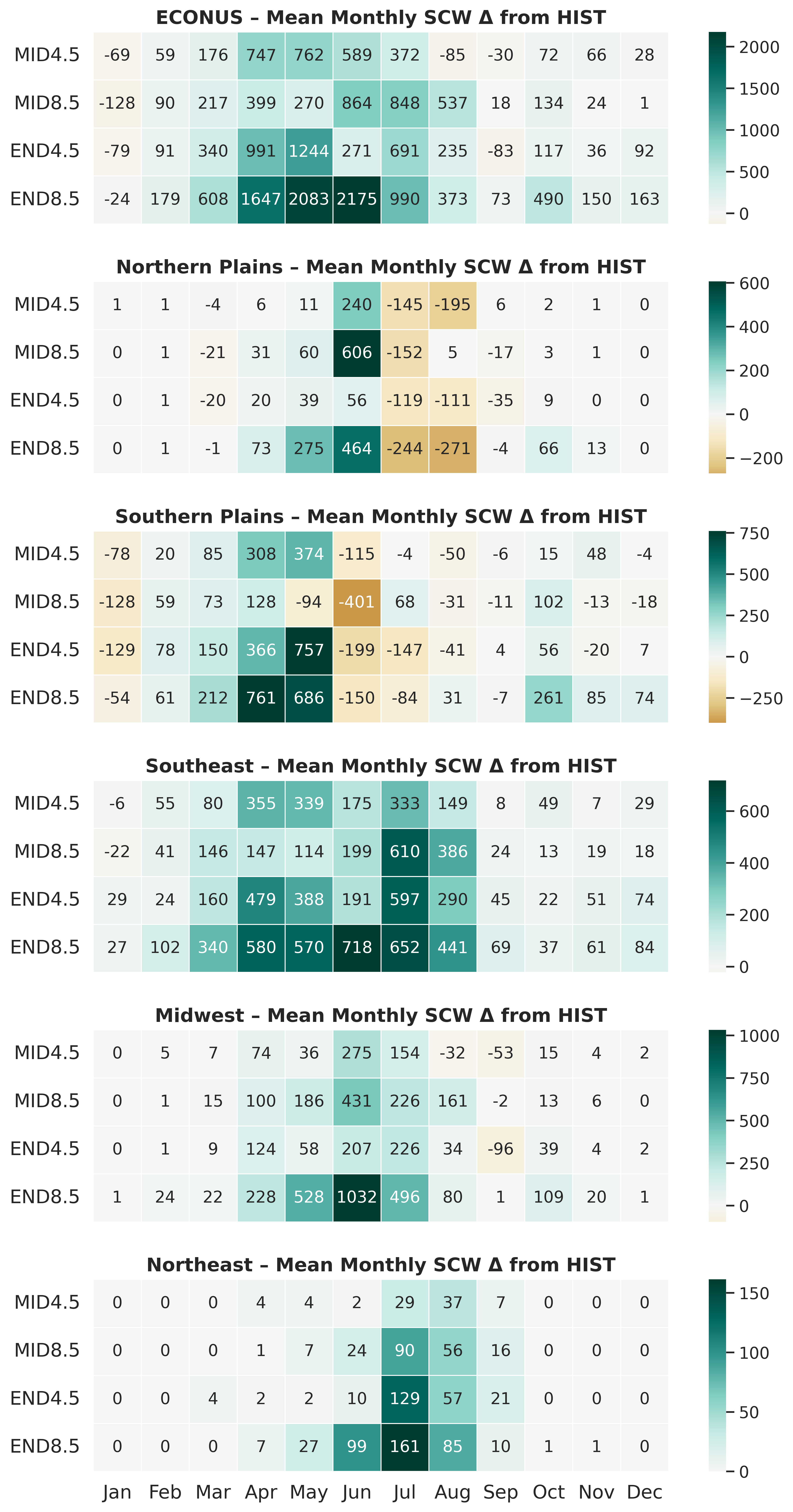
Future of Severe Convective Storms
WRF-BCC climate simulations projecting frequency, variability, and timing changes in severe convective storms by mid- and late-century. (Coming soon)
U.S. Housing Exposure to Severe Convective Weather
GIS analysis of 40 years of severe storm reports, housing, and vulnerability across U.S. counties.
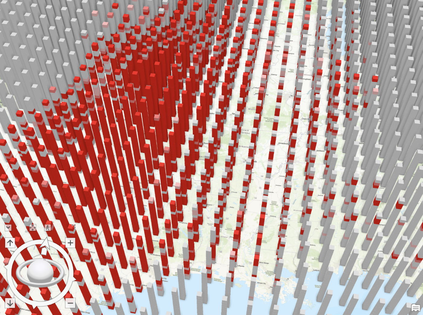
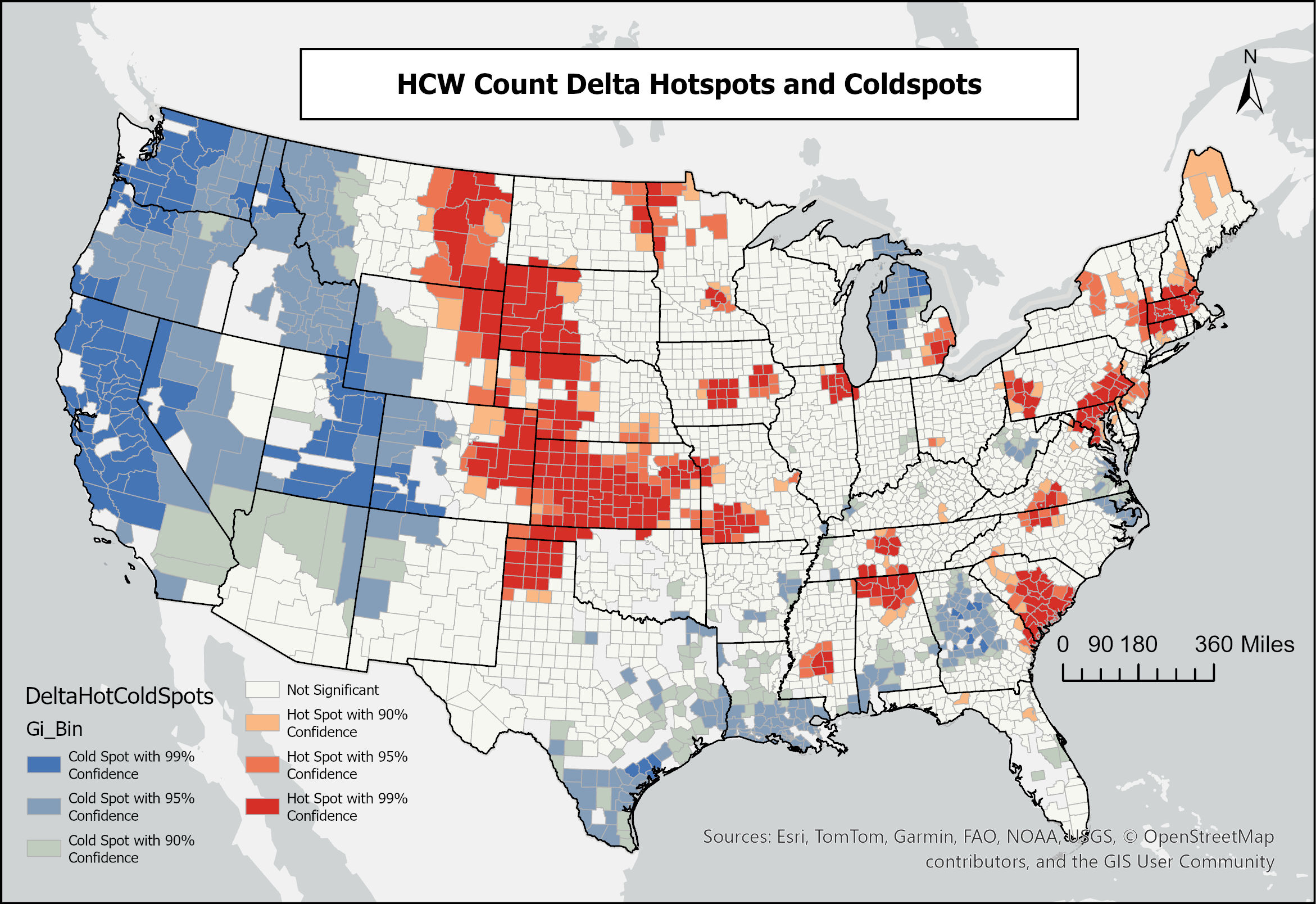
Hotspot Analysis of Future Severe Convective Storms
Looking at projected changes in Severe Convective Weather hotspots in the U.S.
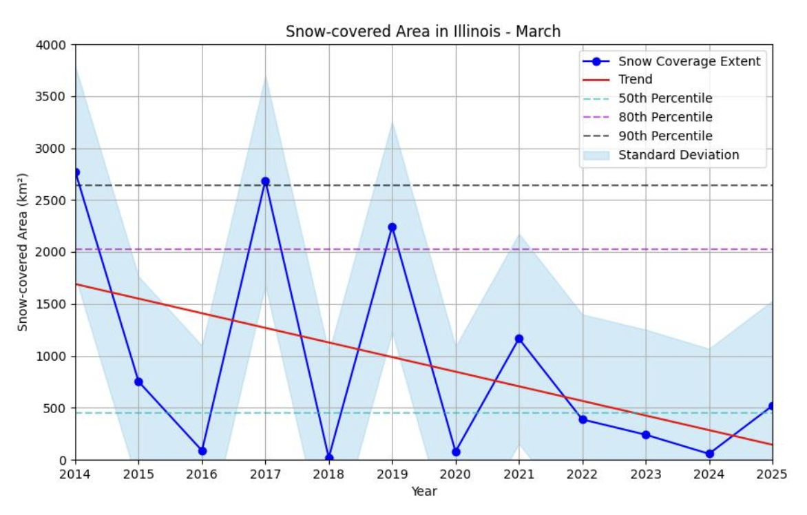
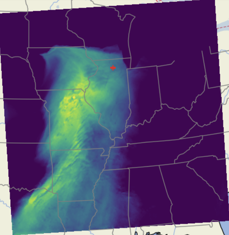
Snow Coverage in Northern Illinois
Landsat-8 remote sensing and NDSI indices used to track long-term snow cover trends.
"Pseudo" Pseudo Global Warming Case Study
WRF sensitivity tests of the March 31, 2023 outbreak with ±2°C perturbations.
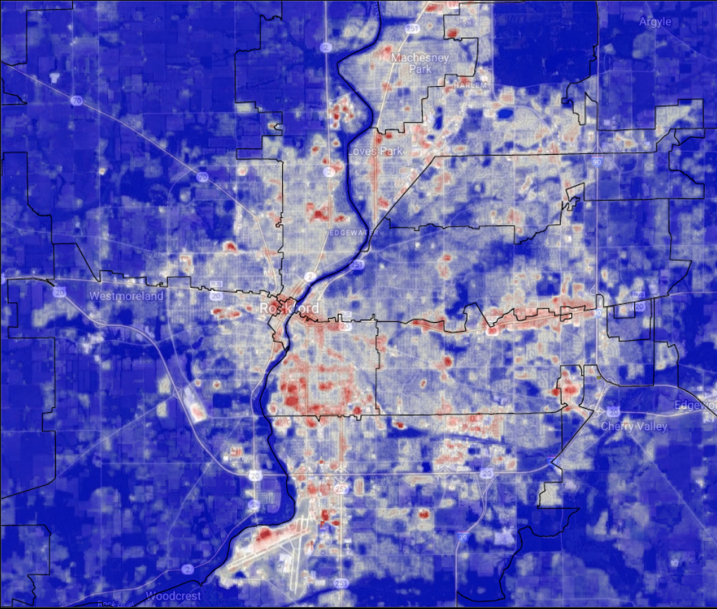
Urban Heat Island Vulnerability in Rockford, IL
Remote sensing + social data reveal heat risk disparities shaped by redlining.
Education Projects
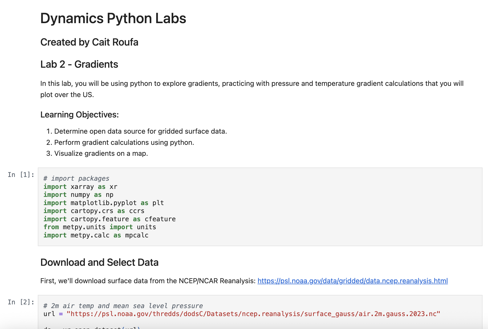
Atmospheric Dynamics Python Labs
Interactive labs for teaching the application of atmospheric dynamics concepts in Python.

STEAM Careers Curriculum
Curriculum bridging high school physics with STEM careers and role models.