Hotspot Analysis of Severe Convective Storms in the U.S.
GIS Term Project • EAE 559 • Spring 2025
Project Summary
This project investigates how severe convective weather (SCW) perils— tornadoes, severe hail, and damaging winds—may shift spatially across the U.S. under future climate scenarios. Using WRF-BCC regional climate simulations and ArcGIS Pro hotspot analysis, I compared historical (1990–2005) and late-21st-century (2085–2100, RCP8.5) epochs. The analysis highlights a projected eastward shift of SCW hotspots away from the Great Plains and toward the Midwest and South, raising important questions about exposure, resilience, and community impacts.
Research Questions
- How does the spatial distribution of SCW perils change under future climate conditions?
- Which regions show emerging or declining hotspots of SCW activity?
- What implications do these shifts have for population and infrastructure vulnerability?
Background
Severe convective weather events already cause immense societal impacts, with increasing losses over recent decades due to both climate and exposure changes. Recent research shows a likely eastward shift of tornado and severe storm activity by the end of the century (e.g., Ashley et al. 2023; Hoogewind et al. 2017). This study contributes by applying explicit convection-permitting model output to GIS-based hotspot and spatiotemporal analysis.
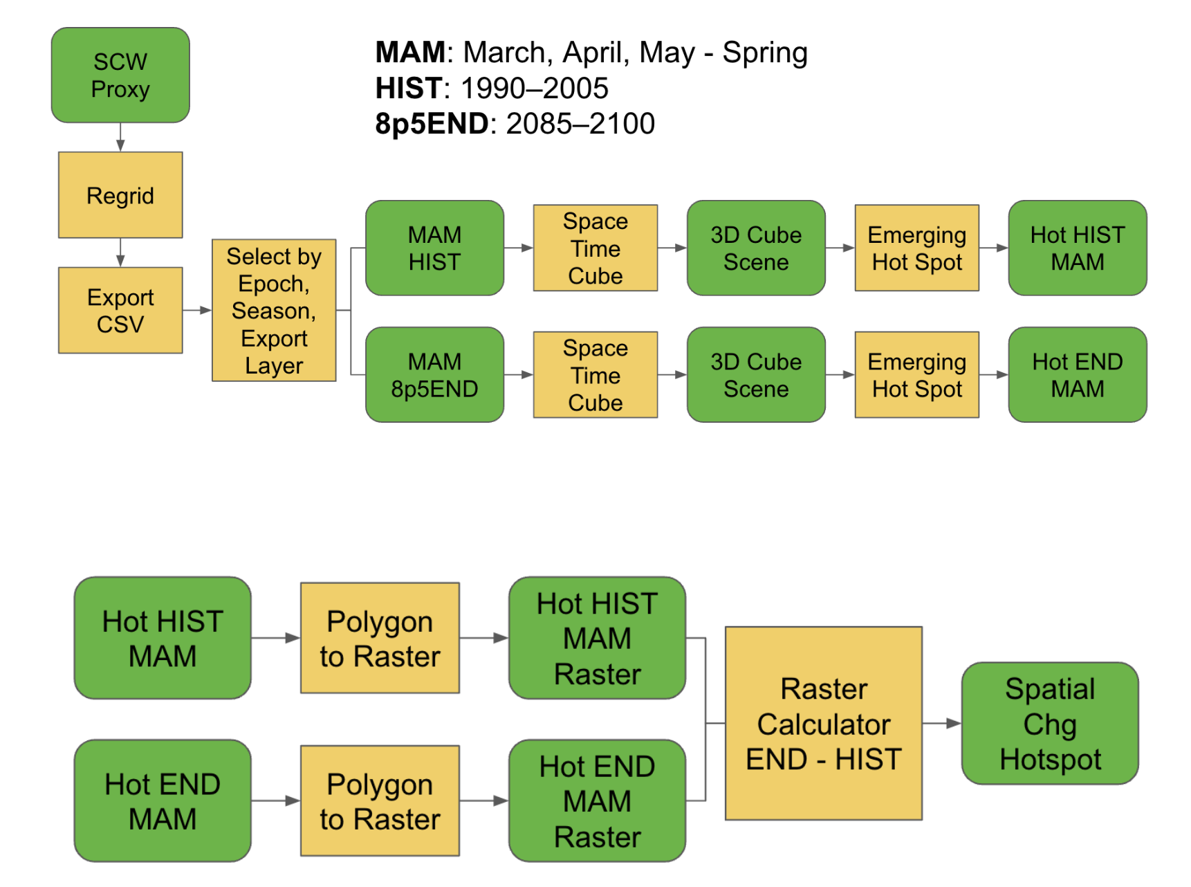
Methods
This project used WRF-BCC model output to quantify changes in hazardous convective weather (HCW) environments across historical and future epochs. Daily event identification was based on thresholded updraft velocity and reflectivity fields, aggregated into seasonal counts. Space-time cube and hotspot analyses were performed to identify shifts in spatial and temporal risk under RCP4.5 and RCP8.5 scenarios.
Results
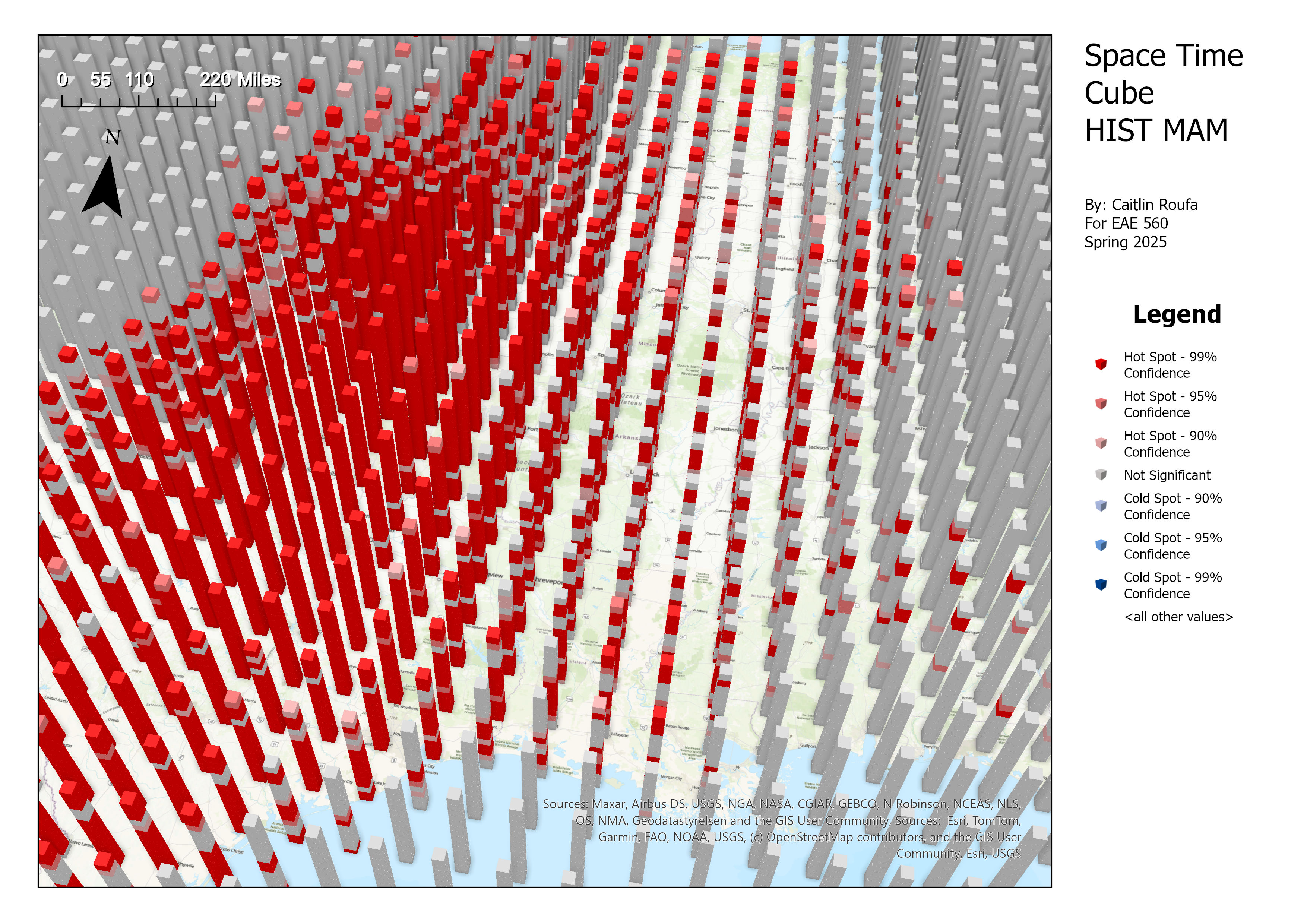
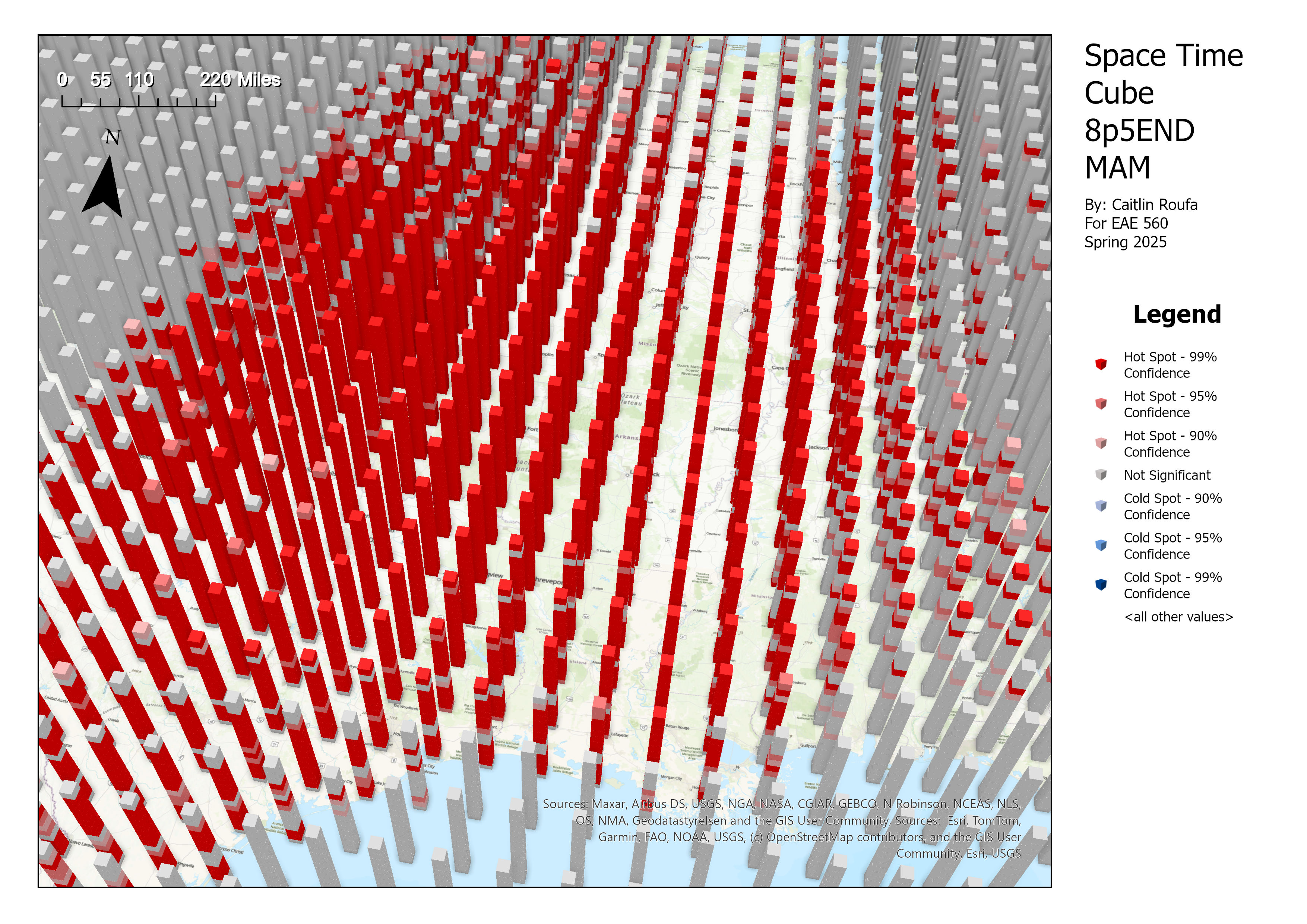
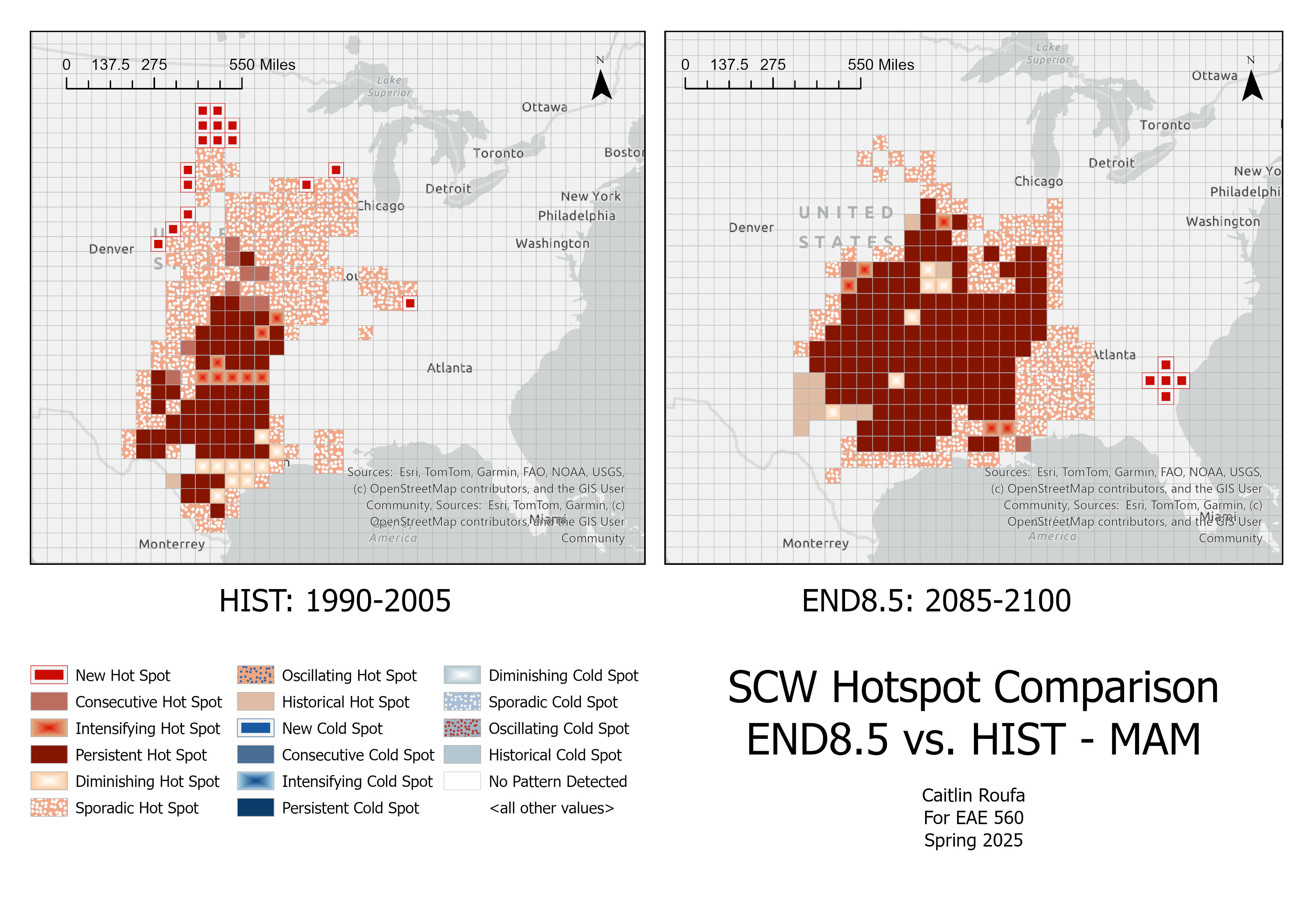
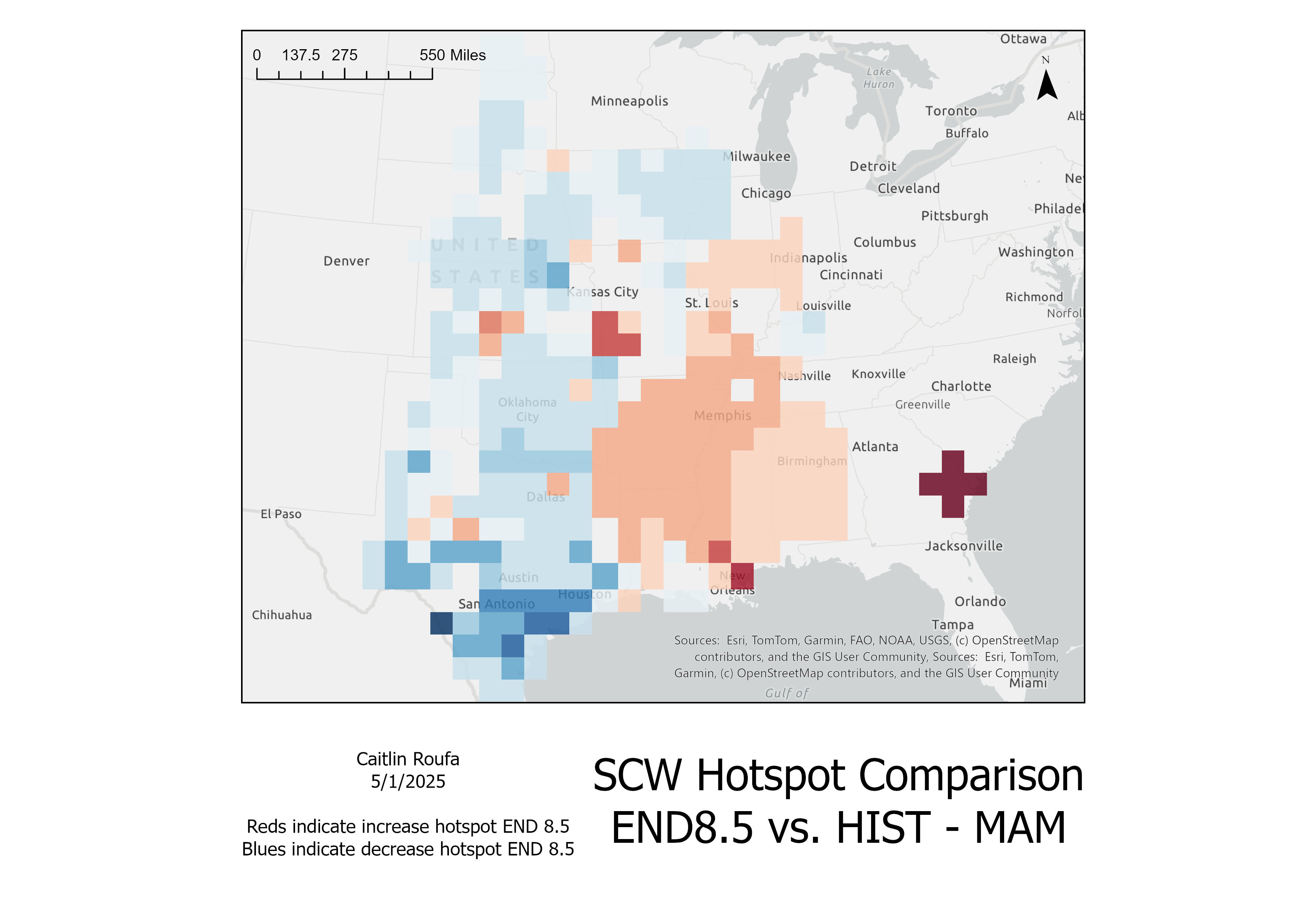
Analysis shows a consistent hotspot over the Great Plains in the historical epoch, shifting eastward into the South and Midwest in the END8.5 scenario during spring.
Discussion & Conclusion
- Shift: SCW hotspots move eastward into the Midwest and South by the end of the 21st century.
- Risk: Populated and infrastructure-dense regions face greater peril.
- Limitations: Only one emissions pathway (RCP8.5) and one season (MAM) considered. SPC Storm Reports used for validation have known biases.
- Future work: Extend to other RCPs and seasons; incorporate exposure and vulnerability overlays.